Baltimore Light Rail
Overview
The light rail line in Baltimore and its suburbs, officially knwon as the "Baltimore Light RailLink", opened in stages beginning in 1992. It serves the downtown portion of the city of Baltimore, and the northern and southern suburban areas, including BWI Thurgood Marshall Airport. The main downtown corridor consists of street-running trackage on Howard Street, and reuses railroad rights-of-way north and south of the city.
The initial segment ran from Timonium Fairgrounds station in Baltimore County to Camden Yards, and opened for limited service on April 2, 1992. A northward extension from Timonium Fairgrounds to Hunt Valley opened September 9, 1997. South from the grade crossing at Warren Road, to North Avenue in Baltimore City, the line uses the former Northern Central Railway (operated by the Pennsylvania Railroad and later Conrail).
South of Camden Yards, the line opened in stages: three stations to Patapsco on August 20, 1992, four stations to Linthicum on April 2, 1993, and two more to Glen Burnie on May 20, 1993. These southern extensions reuse parts of the former Baltimore and Annapolis Railroad and the Washington, Baltimore and Annapolis Electric Railway. A further extension to BWI Airport opened December 6, 1997.
A final extension of the system, a short spur from north of Mt. Royal/MICA station to Penn Station, also opened December 6, 1997. This spur only allows access to trains from Mt. Royal/MICA and south.
Much of the system was built with only a single track, to allow for faster and cheaper initial construction, but this quickly limited the capacity of the line, with long headways. Double-tracking was completed in 2004 and 2006, with the the line north of Gilroy Road, the Penn Station spur, and part of the BWI Airport spur remaining single track.
Station by Station
Hunt Valley. The nothern terminal of the line is adjacent to the parking lots of the Hunt Valley Town Centre (mall). The station itself is an island platform with two tracks. The tracks run past the station about two car lengths. There is a small park and ride parking lot on the south side of the tracks alongside Shawan Road. The double track extends south of the station to just north of Schilling Road where single track begins. Unusually there is no crossover between the tracks along this section, thus trains must operate in both directions on either track into the Hunt Valley terminal.
Pepper Road. Single track, single side platform on the south side of Schilling Road west of Pepper Road.
McCormick Road. Single track, single side platform on the north side of Schilling Circle west of McCormick Road. Note Schilling Road and Schilling Circle are two distinct roads in this area!
Gilroy Road. Double track begins just north of the Gilroy Road station, which consists of two side platforms positioned north of the grade crossing at Beaver Dam Road. Because the single track station begins/ends here, there is almost always a meet of northbound and southbound trains here.
Warren Road. Two tracks, two side platforms, with a large park and ride lot. Note that parking at the Light RailLink stations is free for riders. Departing southbound the trains cross Beaver Dam Road again, and then reach a wye with the former Northern Central Railroad, also known as the Conrail Cockeysville Industrial Track. The NCR main line continued north at this wye, but the remaining industrial track ends short of Cockeysville Road. The NCR rail-trail begins further north at Ashland Road. Conrail service in this area co-existed with light rail service for some years after light rail operation began.
Texas. This not-a-station was planned and an island platform built during the 2005 double-track project, but never completed. There are actually three tracks in this area, allowing trains not running all the way to Hunt Valley to turn back and lay over in this area.
Timonium Fairgrounds (Park & Ride). Two tracks, two side platforms. This station has a large park and ride on the west side of the tracks, and direct pedestrian entrance to the Fairgrounds on the east side of the tracks. A large medical center facility opened in 2020 adjacent to the park and ride lot. The Timonium Fairgrounds station was the original northern terminal of the line.
Timonium (Business Park). Two tracks, two side platforms located north of the grade crossing at Business Park Drive. If you are railfanning the line stop for breakfast or lunch at Baltimore Coffee Company across the street from the station platforms. If you're lucky you'll smell them roasting coffee beans.
Lutherville. Two tracks, two side platforms a very short distance south of the Timonium Business Park station (in fact, its quite easy to see the stations from each other). Large park and ride lot and bus terminal here.
Between Lutherville and Falls Road there is a long stretch without a station. The line passes the location of former stations in the Ruxton area, when the line was still operated as the Northern Central Railroad. Residents of the area were not interested in reopening a station in this area when the light rail was built in 1992. In the Lake Roland area there is a bridge over Lake Roland / the Jones Falls, and a grade crossing of a hiking trail alongside Lake Roland. This hiking trail follows a spur of the NCR railroad which ran to Owings Mills. There are still visible rails in the woods alongside the trail.
Falls Road. Two tracks, two side platforms. Large park and ride lot here. This station is adjacent to the entrance to the Lake Roland county park.
Mt. Washington. Two tracks, two side platforms. Small park and ride lot. The Mt. Washington station serves the small "village" of Mt. Washington in the Jones Falls valley. Good place to stop and eat while you are railfanning the line. Try Abbey Burger. South of here the tracks closely parallel the I-83 Jones Falls Expressway.
Cold Spring Lane. Two tracks, two side platforms. Access to the station from the street is down a series of ramps or stairs from Cold Spring Lane, There is not much in the area to walk to but the station is heavily used by students from Baltimore Polytechnic Institute/Western High School on Cold Spring Lane. North of the station are the remains of an industrial spur track which served a now-defunct vinegar plant.
Woodberry. Two tracks, two side platforms. Woodberry is a little neighborhood in the Jones Falls valley, with light industry and some warehouses converted to housing and restaurant spaces. The "Avenue" of the Hampden neighborhood is a short walk first east on Union Avenue, then south on Falls Road.
Before reaching North Avenue station, the tracks pass alongside the Light Rail yard and shops, located on the west side of the tracks. The yard tracks are on the west side of the shops and thus hard to see from the passing trains.
North Avenue. Two island platforms with three tracks in the shadow of the North Avenue bridge. Very small park and ride lot here. This station serves Baltimore's Bolton Hill, Station North, and Mount Royal neighborhoods. The northwest end of MICA, the Maryland Institute College of Art, is a short walk west on North Avenue.
Penn Station. Penn Station's light rail station is at the end of a short single-track spur line which connects to the main line north of Mt. Royal/MICA station. The spur only allows access to trains heading to or coming from the south. The station has been closed for several years while Amtrak rebuilds Penn Station.
Mt. Royal/MICA. Two tracks, two side platforms located north of the grade crossing of Mount Royal Avenue. This station serves MICA (Maryland Institute College of Art), the campus of the University of Baltimore, the Lyric Theater, and is a three-block walk from Penn Station. Passengers heading to/from the north may find it is faster to walk to Penn Station from here rather than transfer to a Penn Station-bound light rail train... when these are in normal operation.
Cultural Center. Two tracks, two side platforms. Located adjacent to the hall of the Baltimore Symphony, a military history museum, and a short walk west to the State Center office complex (and to the Baltimore Subway at State Center). To the east is the Mid-Town/Belvedere and the north end of the Mount Vernon neighborhoods. South of here the line begins street-running portion along Howard Street.
Centre Street. Two tracks, two side platforms with lanes of Howard Street alongside. The core of the Mount Vernon neighborhood, with the Walters Art Museum, the Washington Monument, the Peabody Library, and the Baltimore Basilica are to the east.
Lexington Market. Two tracks, two side platforms with lanes of Howard Street alongside. To the west one block is the Lexington Market station of the Baltimore Subway on Eutaw Street. The Maryland MTA advertises this as the official transfer point between the light rail and subway. The recently reopened Lexington Market is at the subway station on Eutaw Street.
University Center/Baltimore Street. Two tracks, two side platforms with lanes of Howard Street alongside. This station serves the CFG Bank Arena directly alongside and the Hippodrome Theater one block west on Eutaw Street.
Pratt Street/Convention Center. Two tracks, two side platforms. Diverging from but still parallel to Howard Street, this station serves the Convention Center and the north gates of Oriole Park at Camden Yards. This is the closest stop to the attractions of the Inner Harbor, a few blocks east along Pratt Street. A few blocks west along Pratt Street you will find the Baltimore and Ohio Railroad Museum.
Camden Yards. Three tracks, one island and one side platform. This station is, unsurprisingly, adjacent to Camden Yards and the Camden station of the MARC Camden Line. The north end of the Federal Hill neighborhood and the Maryland Science Center are a short walk east on Conway Street, then south on Light Street.
Stadium/Federal Hill (Hamburg Street). Two tracks, two side platforms. Opened as an infill station on September 6, 1998, to serve M&T Bank Stadium, it was initially only open during stadium events but is now open full-time. To access the stadium one must walk east along the station driveway underneath the I-395 overpass, then double back on Hamburg Street. Continue east on Hamburg Street for the Federal Hill neighborhood and Cross Street Market. South of this station the tracks cross a long viaduct over the Patapsco River.
Westport. Two tracks, two side platforms. This station serves a very small neighborhood west of the station. Presumably not a whole lot of ridership here.
Cherry Hill. Two tracks, two side platforms. This station serves a small light industrial area east of the station. Again, presumably not a lot of ridership here.
Patapsco Avenue. Two tracks, two side platforms. Small park and ride here. Located at the far northeast corner of the Baltimore Highlands neighborhood but presumably most ridership comes from bus transfer.
Baltimore Highlands. Two tracks, two side platforms. Located about midway south along the eastern edge of Baltimore Highlands neighborhood. This station is not very far from Patapsco Avenue but Patapsco Ave. has a bus transfer area whereas this station is more directly adjacent to the residential area.
Nursery Road. Two tracks, two side platforms. Small park and ride. North edge of a residental suburban area.
North Linthicum. Two tracks, two side platforms. Larger park and ride compared to Nursery Road but serves the southern edge of the same residential area.
Linthicum. Two tracks, two side platforms. Serves a residental area west of the tracks and a small commercial area on Camp Meade Avenue to the east. Shortly to the south of here the two southern branches (to Glen Burnie and to BWI Airport) diverge at a double-track level crossing.
Ferndale. Continuing the original alignment to the southeast from the junction, this station has two tracks, two side platforms. Serves a residential area and commercial strip along Baltimore-Annapolis Boulevard.
Cromwell Station/Glen Burnie. Two tracks, one island platforms. Prior to arriving at the terminal station there is a diverging track serving the Cromwell Light Rail yard and maintenance shops. There is a large park and ride and bus transfer here. The Cromwell Field Center shopping center is across the street from the station. The station is a ways from the center of Glen Burnie south down Baltimore-Annapolis Boulevard.
BWI Business District. Continuing southwest from the junction mentioned above, trains arrive at this station consisting of two tracks, two side platforms. Pedestrians would only alight here to walk aways west on Elkridge Landing Road the BWI business district (office buildings, hotels, a few restaurants) or south into the Air Cargo area of the airport. To the south of the platforms is a a large parking lot for BWI airport employees but there is no pedestrian access from the station to the lot. There's a very small park and ride on the north side of the platforms.
BWI Airport. The two track line continues across Aviation Boulevard onto BWI Thurgood Marshall Airport property, with a short section of single track squeezed in between two roadways, before entering the airport terminal station, which consists of two tracks and a single island platform. Terminal E is adjacent to the south end of the platform.
Route Map

Roster
| Numbers | Type | Manufacturer | Year Built | Notes |
|---|---|---|---|---|
| 5000-5034 | MDOT LRV | ABB Traction | 1991-1992 | |
| 5035-5052 | MDOT LRV | AII/AdTranz | 1997-1999 |
Photos
Photo Search
Photo Gallery
| Five Random Images | ||||
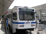 Image 79949 (268k, 1044x788) Photo by: David-Paul Gerber Location: BWI Airport | 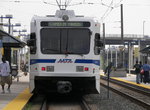 Image 79957 (253k, 1044x788) Photo by: David-Paul Gerber Location: Camden Yards | 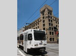 Image 134150 (330k, 788x1044) Photo by: David Pirmann Location: Howard & Lombard |  Image 161775 (399k, 1220x820) Photo by: David Pirmann Location: Pratt Street/Convention Center |  Image 161825 (425k, 1220x820) Photo by: David Pirmann Location: Woodberry |
Photos By Location
Photo locations: Hunt Valley, Pepper Road, McCormick Road, Gilroy Road, Between Gilroy Road and Warren Road, Warren Road, Texas (unbuilt station), Timonium Fairgrounds, Timonium Business Park, Lutherville, Between Lutherville and Falls Road (Ruxton/Lake Roland Area), Falls Road, Mt. Washington, Cold Spring Lane, Woodberry, North Avenue, Penn Station, Mt. Royal/MICA, Cultural Center, Centre Street, Howard & Franklin, Lexington Market, Howard & Fayette, University Center/Baltimore Street, Howard & Lombard, Pratt Street/Convention Center, Camden Yards, Stadium/Federal Hill (Hamburg Street), Westport, Cherry Hill, Patapsco Avenue, Baltimore Highlands, Nursery Road, North Linthicum, Linthicum, Ferndale, Cromwell Station/Glen Burnie, BWI Business District, BWI Airport
Links
Washington, Baltimore and Annapolis Electric Railway
Baltimore and Annapolis Railroad
Page Credits
Station by Station by David Pirmann. Map by Michael Calcagno.
| ||||||||||||||||||||||