Sacramento, California
![]()
Sacramento CAF LRV #239 approaching Sacramento Valley Station. Photo by Peter Ehrlich, May 2008.
Overview
Sacramento's light rail system began operations in the state's capital in 1987. The system was built to be inexpensive, originally being 60% single track. Major funding for the original system came from canceling a new freeway project that was underway and diverting the funds to light rail instead. In fact, a section of the light rail system was built on the unfinished freeway structure.
Since the original opening, large portions of the system have been double tracked, a few stations have been added to fill in gaps, and the end of the Folsom Line has been extended a couple of miles to a new station. In September 2003, a new branch was completed heading south from downtown, and the Folsom Line is being extended 10 miles to finally reach Folsom.
The system still uses its original fleet of 36 Siemens-Duewag U2A cars, which are very similar to the trolleys in San Diego. 40 new vehicles from the Spanish firm Construcciones y Auxilar de Ferrocarriles (CAF) have been ordered to handle the service expansion of the south and Folsom lines.
A 15 minute headway is maintained throughout the day which drops to 30 minutes at night. During rush hour, trains double in length to 4 cars. Single cars are sometimes run on the weekend. Most of the bus lines have been reconfigured to serve as feeders for the light rail, thus reducing the bus traffic downtown.
Route Map

Track Map

Station By Station
Original Line
We will begin our tour of light rail in Sacramento at the northeast end of the system, Watt/I-80. This station is built in the wide median of Interstate 80 on what was originally going to be the start of a new freeway. The station is located directly under the Watt Ave. overpass. There are stairs connecting the two, allowing transfers between light rail and the numerous buses that stop overhead on Watt Ave. There are also a number of rush hour busses that stop at track level.
As we leave Watt/I-80 and head southeast toward town, the line becomes single tracked and we stay on the unfinished freeway in the middle of I-80. Most of the unfinished freeway has been converted to a giant parking lot. The next station, Watt/I-80 West, is a lonely little stop that is only made upon request.
It serves mainly as access to the Western half of the parking area.
The line remains in the I-80 median until reaching the next stop of Roseville Road. After leaving Roseville Road, double track resumes. The line continues on the abandoned freeway structure until reaching the Union Pacific right of way, which it will follow the next few miles. The next stop is Marconi/Arcade followed by Swanston. The main train yard for the system is located between the two stations. Right after leaving Swanston, the line becomes single tracked and veers away from the Union Pacific right of way. A series of sharp curves are then negotiated to reach the next station, Royal Oaks. The line then uses an abandoned Sacramento Northern right of way that follows city streets. The tracks parallel Arden Way until reaching Arden/Del Paso. The tracks then run down the middle of Del Paso Blvd. to reach the Globe Avenue station. After leaving Globe Avenue, the line becomes a single track to cross the American River and some railroad tracks. The line does not get its own bridge, but rather a reserved lane on the bridge for Del Paso Blvd. As the line nears downtown, it starts running down 12th Street, which ducks under the former Southern Pacific main line just before arriving at the Alkali Flat/La Velentina station. Since 12th Street is one way, the track going against traffic gets a reserved lane. The other track shares its lane with street traffic. A stop is made at 12th & I a few blocks before the tracks turn onto K Street. The five blocks of K Street shared with light rail have been converted into an auto free pedestrian mall. The Cathedral Square and St. Rose of Lima Park stops are located along the K Street mall. At the end of the K Street mall, the tracks turn and head south along 7th and 8th, two parallel one way streets. This is also the area where a future extension will branch off to reach the Sacramento Amtrak station, five blocks away. The next stop is at Capitol Mall (7th & Capitol and 8th & Capitol). From these stops, the California state capitol building can be seen at the end of the mall. The tracks continue down 7th and 8th until reaching O street, where they turn east and come together again. Trains stop at 8th & O and then Archives Plaza before turning south on 12th Street. As the name suggests, state office buildings line this section of O Street. This time, the tracks only stay on 12th street for two blocks before turning east and leaving street trackage. There is a small three track yard located at the corner where the tracks trun. The "R Street Yard" was one regularly used to turn extra cars removed from eastbound trains. The next two stops, 13th Street and 16th Street, are connected with a short section of private right of way that parallels R Street. As the trains make their way along the private right of way, cross streets are blocked with crossing gates. This is a feature common on the rest of the line east towards Folsom, but almost non-existent on the northern part of the line. Upon leaving 16th Street, the South line tracks split off and follow the Union Pacific Railroad tracks 6 miles south to Meadowview Rd., and the original line climbs up onto the "Bee Bridge". Originally a single-track bridge, a new viaduct for inbound trains was constructed in conjunction with the South Line project. This bridge is so named because of its proximity to the Sacramento Bee newspaper plant. The old Western Pacific main line (of California Zephyr fame) is crossed here. The tracks return to grade level next to The Sacramento Bee building and the 23rd Street station. The Bee is Sacramento's main newspaper.
Folsom Line
After leaving 23rd Street station, the tracks continue down R Street, which in this area looks more like an alley than a main street. The next station, 29th Street, is located under the Highway 99 overpass. Soon after leaving 29th Street station, street running is left behind for good. The next two stations, 39th Street and 48th Street, were not included in the original system, but were added in 1994. They are located in the middle of quiet residential neighborhoods, and were the first stations which were architecturally radically different from Regional Transit's standard "cookie cutter" station design. Although the stations are very nice, they seem to be rather lightly used. The next stop is 59th Street.
University/65th Street is the next stop and is a major transfer point for connecting bus lines. Upon leaving the station, the tracks negotiate a double track bridge to hop over more Union Pacific Railroad tracks. Upon reaching the other side, the line begins following the ex-Southern Pacific Folsom branch line. Originally single track between this viaduct to just west of Watt/Manlove station, a second track was added as part of the new South Line and Folsom Extension projects. The next two stops, Power Inn and College Greens, originally had platforms on the north side only, but new platforms on the outbound (south) track were built. At College Greens, the tracks start paralleling Folsom Boulevard, which they will continue to follow to the end of the line. The next stop, Watt/Manlove, was built with double tracks and two side platforms.
Stops are then made at Starfire and Tiber before reaching the original end of the line at Butterfield. The line then continues to Mather Field/Mills, which was reached on September 6, 1998. Construction of a new station between Butterfield and Mather Field/Mills, Horn Road, has been deferred until funding is identified. Extending service between Butterfield and Mather Field/Mills without needing more vehicles was accomplished by taking advantage of a 10 minute lay over that existed at Butterfield.
On June 13, 2004, the Folsom line was further extended into the city of Rancho Cordova, with new stations located at Zinfandel, Cordova Town Center and Sunrise. A small yard is located here for storage of cars during off-peak periods on weekdays. Trains now get a decent layover--20 minutes. It is estimated that by summer 2005, the line will be further extended eastward to Folsom, with a station in the Historic Folsom downtown district being the terminus. Intermediate stations will be added at Hazel Avenue, Iron Point Road and Silverbrook.
As part of the project, new double track sections were added to the Bee Bridge and from west of Power Inn to Watt/Manlove, with new platforms added at Power Inn and College Greens stations accordingly.
South Line
Phase 1 of the new South Line opened for service on eptember 26, 2003. It is a 6.3-mile line whose cost was $222 million. The line parallels Union Pacific's former Western Pacific main line, where the famous California Zephyr all-stainless steel cruise train once ran. Like the East Line, all intersections are controlled with crossing gates.
The south line begins at Bee Junction (18th and R Streets) and curves southward to meet the UP. Inbound South Line trains must pass under the East Line's Bee Bridge, which was double-tracked as part of the project. The first station on the line is Broadway, which serves Auto Zone. This is a walk-in station with spectacular triangular arches and a matching canopy covering the outbound track. A center platform serves inbound trains, while outbound trains load onto a side platform. This is the pattern for most of the stations on the new line.
Continuing the trend started with the addition of two stations on the East Line in the late 1990s, stations on the new South Line feature much art and sculpture, created by local artisans. Each station has a completely different look and feel, unlike the economical cookie-cutter station architecture seen on the original system. Broadway sports one of the more spectacular such treatments.
South of Broadway, the route makes a gentle curve to the southeast and crosses busy but narrow Freeport Blvd, into 4th Avenue/Wayne Hultgren station, another walk-in facility serving the working-class neighborhood of Curtis Park. McClatchy High School is located nearby along Freeport Blvd. Another half-mile or so of riding will reach City College station, which is bordered on the west by the campus, parking lot and Hughes Stadium, and on the east by the old Western Pacific South Sacramento freight yard. One can usually see a UP GP-38-2 or similar locomotive idling here as it waits for assignment. Looking north, one can see the Sacramento skyline--a nice backdrop for an approaching outbound train.
While riding, be sure to watch for the sound walls--mostly on the east side of the tracks--which have been painted with leaves and windows in an attempt to ward off graffiti. So far, this seems to have worked.
Following City College, the distance between stations increases to a mile apart. The next station is Fruitridge, with its copper-clad main platform canopies and smaller ones over the ramps for wheelchair users. Although there is a side platform on the outbound track, it is not used and all boarding/alighting in both directions takes place from the center island platform.
After Fruitridge comes 47th Avenue Station, the first one to feature parking. The architecture forms part of a plaza for passengers waiting for buses or trains. The Campbell's Soup plant and the Brentwood and Fullerton neighborhoods are a short walk from the station. Next comes Florin Station, which serves Florin Road, the major east-west boulevard in South Sacramento. The line's largest parking facility and a major bus transfer center are located here. The station canopies curve downward on the west side to protect from wind and rain.
Leaving Florin, the line swoops over Florin Road on its only overpass, made necessary by the volume of traffic. In another mile, riders will arrive at the current end of the line, Meadowview Station. Curved canopies line the west track--currently the only one in use (in most cases). The mosaic artwork is embedded in the canopy supports. Another large and expandable parking lot is at Meadowview. Track storage for up to six LRVs is just south of the station, and the walkway to Meadowview Road parallels the stub tracks.
The equipment used on the South line consists entirely of new CAF LRVs in the 200 series. The delivery of the pilot car, 201, occurred in August 2002, and ultimately there will be 40 of these cars, some of which will enter service in 2004 on the East Line when it is extended to Folsom. The CAF LRVs can trainline with the older Siemens/Duewag 100s, but for now the two fleets are kept separate.
Currently, four trains of 1, 2 or 3 cars are sufficient to run the line at RT Metro's standard 15-minute headways. The running time between Meadowview and St. Rose of Lima Park is 22-23 minutes. Like the other line, headways drop to half-hourly after 7:30pm. On a recent Saturday, one-car trains were operated until noon, and a second car was added at either Meadowview or 13th Street. The schedules between the two routes interface at 16th Street, and convenient transfers can usually be made there.
Phase 2 of the South Line will extend the line further south and east into southern Sacramento County. Funding is already in place, and preliminary engineering is underway. By the end of 2004, the final environ- mental reports should have been submitted, with final engineering and construction continuing to 2007. The route will follow the UP another mile to the Cosumnes River basin, whence it will turn east, ending at Calvine/Auberry. Three intermediate stations are proposed: Franklin Boulevard, Center Parkway and Cosumnes River College/College Square.
Roster
Photo Gallery
| Five Random Images | ||||
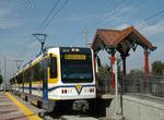 Image 27237 (140k, 720x478) Photo by: Peter Ehrlich Location: Fruitridge | 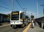 Image 32915 (141k, 720x478) Photo by: Peter Ehrlich Location: University/65th | 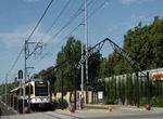 Image 32950 (178k, 720x478) Photo by: Peter Ehrlich Location: Broadway | 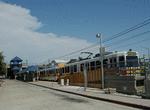 Image 32976 (111k, 720x478) Photo by: Peter Ehrlich Location: Watt/I-80 | 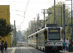 Image 73385 (175k, 864x564) Photo by: Peter Ehrlich Location: 16th Street |
Photos By Location
Photo locations: Watt/I-80, Watt/I-80 West, Roseville Road, Marconi/Arcade, Swanston, Swanston Yard, Royal Oaks, Arden/Del Paso, Globe Avenue, Alkali Flat/La Valentina, 12th & I, 12th & K, 11th & K, 10th & K, Cathedral Square, K Street Mall, 8th & K, 9th & K, St. Rose of Lima Park, 7th & K, 7th & Capitol, 8th & Capitol, 8th & O, 9th & O, Archives Plaza, 12th & Q, 12th St. Yard, 13th Street, 16th Street, 17th St. (Between Q & R), 18th St. (Between Q & R), Bee Junction/Bee Bridge, 23rd Street, 29th Street, 39th Street, 48th Street, 59th Street, University/65th, Power Inn, College Greens, Watt/Manlove, Starfire, Tiber, Butterfield, Horn, Mather Field/Mills, Zinfandel, Cordova Town Center, Sunrise, Hazel, Iron Point, Glenn, Folsom, S Street-South Line, T Street-South Line, Broadway, 4th Avenue/Wayne Hultgren, City College, Fruitridge, 47th Avenue, Florin, Meadowview, 7th & I/County Center, Sacramento Valley Station (Amtrak), 8th & H, 8th & L, 12th & O
Links
Official Site - Sacramento Regional Transit. The official site of the Sacramento light rail, including schedules, fares, and more.
Page Credits
By Eric Haas and Peter Ehrlich. Maps by Michael Calcagno.