Marseille, France
![]()
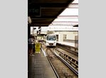
Marseille's Tram Line T1 at Les Caillols. Photo by François Lapadu-Hargues, September 2008.
Overview
Marseille's tram system was the longest continuously-operating tramway in France, dating to 1876. However, by 1960, all lines except Route 68-Noailles to St.-Pierre had been abandoned. The 3km long Route 68 was saved because of its underground approach to Noailles through an 1893-vintage tunnel. Following rebuilding of the tunnel and the line along Blvd. Chave in 1966, Route 68 was re-equipped with a small group of double-end PCCs built by Belgium's La Brugeoise. It operated with these vehicles until January 8, 2004, when the line was closed for rebuilding into a more modern LRV tramway. The section along Boulevard Chave to Eugène Pierre reopened in August 11, 2007; the tunnel to Noailles reopened September 29, 2008.
While Tram T1 was being upgraded, work was simultaneously progressing on a new T2 tram line, linking Euroméditerranée in the northwest with Blancarde Foch and Les Caillols in the east. At Blancarde Chave a track connection was made to the existing 68/T1 tracks, and line 68/T1 was extended beyond St.-Pierre to Les Caillols. Service on the new T2 and the 68/T1 section from Blancarde Chave to Les Caillols began June 30, 2007. When the T1 reconstruction work was completed in September 2008, the T2 was cut back to Blancarde Chave, and the T1 line serves Les Caillols exclusively.
Route Map

Photo Gallery
| Five Random Images | ||||
 Image 59277 (185k, 1044x698) Photo by: Thierry Leleu |  Image 74016 (112k, 544x820) Photo by: Bernard Chatreau Location: La Rose (1) |  Image 88342 (132k, 774x501) Photo by: Brian J. Cudahy Location: Depot de Saint-Pierre |  Image 125553 (106k, 560x850) Photo by: Bernard Chatreau Location: La Rose (1) |  Image 125607 (318k, 1044x788) Photo by: Bernard Chatreau Location: Les Caillols |
Photos By Location
Metro
Photo locations: La Rose (1), Frais Vallon (1), Between Frais Vallon and Malpasse (1), Malpasse (1), St. Just/Hôtel de Département (1), Chartreux (1), Cinq Avenues/Longchamp (1), Réformés/Canebière (1), Gare St. Charles (Gare SNCF) (1), Colbert/Hôtel de Région (1), Vieux-Port/Hôtel de Ville (1), Estrangin Préfecture (1), Castellane (1), Baille (1), La Timone (1), La Blancarde (1), Louis Armand (1), St. Barnabé (1), La Fourragère (1), Bougainville (2), National (2), Désirée Clary (2), Joliette (2), Jules Guesde (2), Gare St. Charles (Gare SNCF) (2), Noailles (2), Notre Dame du Mont/Cours Julien (2), Castellane (2), Périer (2), Rond Point du Prado (2), Sainte-Marguerite Dromel (2), (Misc/Unknown)
Tram T1 (68)
Photo locations: Noailles, Noailles Tunnel Portal, Bruys, Between Chave Bruys & Pierre, E. Pierre, Escoffier, George, Between George & J. Martin, J. Martin, Between J. Martin & Blancarde, Blancarde Chaves, Ste. Therese, Between Ste. Therese & St.-Pierre, Saint-Pierre, Depot de Saint-Pierre, Between St. Pierre & La Parette, La Parette, Between La Parette & La Boiseraie, La Boiseraie, Air Bel, La Grognarde, W. Booth, Les Caillols, (Misc/Unknown)
Tram T2
Photo locations: Euromediterranée Arenc, Euromediterranée Gantès, Joliette, Republique Dames, Sadi Carnot, Cours Belsunce, Belsunce Alcazar, Rue de Rome, Canebière Garibaldi, Cours St. Louis, Noailles, Réformés Canebière, National, Between National and Longchamps, Longchamps, Between Longchamps and Cinq Avenues, Cinq Avenues, Between Cinq Avenues and F. Sakakini, Foch Sakakini, Between F. Sakakini and F. Boisson, Foch Boisson, Between F Boisson and F. Blancarde, Blancarde Foch, (Misc/Unknown)
Page Credits
By Peter Ehrlich. Route Map by François Lapadu-Hargues.