MUNI Metro Lines (J, K, L, M, N)
![]()
MUNI Breda LRV 1401 switching back on crossover on Ocean Avenue west of San Jose Avenue. Photo by Peter Ehrlich, June 2005.
Overview
As with many US cities, San Francisco had an extensive streetcar system before World War II. After the war, San Francisco began bus-substitution, due in part to the availability of the diesel bus and the consolidation of the previously private Market St. Railway into the city owned Municipal Railway. In San Francisco's case, however, the utilization of inexpensive hydro power from the City's Hetch Hetchy Power Department led Muni to invest in a large fleet of electric trolley coaches, in addition to motor coaches, as streetcar replacements.
While many major routes and all of the smaller lines went rubber tire, five streetcar routes survived. As the elderly PCC's rolled up and down the surface of Market St., a new subway, called BART, was being planned for under Market St. The BART design called for two 2- track tunnels, one on top of the other, one to provide "express" Transbay service and the other to provide services to the south and west regions of San Francisco. In many respects this was an update of a plan first proposed in the twenties, which called for a four-track tunnel which would link up in part to the Twin Peaks tunnel. After much debate, and after construction of the multilevel BART tunnels had started, the MUNI was assigned the upper level tracks to relocate its streetcars from the surface in the downtown area.
Opened in 1980, the MUNI Metro is conceptually similar to the Boston and Philadelphia subway-surface streetcar systems where surface lines funnel into a single tunnel to serve the downtown core. Unlike those two systems, which have loops at the ends, the MUNI was designed with a stub-end terminal and high level platforms, rendering the current fleet of PCC cars unusable. A new LRV design was required, and both Boston and San Francisco purchased these new LRV cars from Boeing. Promised for delivery in 1976 but not received until 1982 (and still with flaws), the fleets have not aged well in either San Francisco or Boston. Boston even went so far as to refuse part of its order, which San Francisco then purchased. Service problems came to a head in the summer of 1998 as MUNI attempted a simultaneous rollout of a proof-of-payment fare system, a new ATC signaling and control system, a new extension of the Metro to the Caltrain Terminal, and integration of the new but incompatible Breda LRV-2 cars. The Breda cars, which cannot MU with the Boeings, can be found on all five lines, with the N line being exclusively Breda (since August 1998). The Boeing have since been entirely replaced by the Bredas. Standard operating procedure for many years had been to MU cars on the K, L, and M for their runs thru the Metro and Twin Peaks Tunnel, coupling/decoupling at West Portal. This procedure has not been used much since the implementation of ATC.
The MUNI Metro opened in February 1980 when the N-Judah began weekday service into the subway (Embarcadero to Van Ness Stations). Service to Church, Castro, Forest Hill and West Portal Stations began in June 1980. Weekday service only continued to November 1982, when weekend service was added for the first time.
The MUNI Metro has not caused the removal of all streetcars from Market Street. In fact, the "F-Market" line, operated with restored SEPTA PCC cars, is a big hit with both tourists and residents alike. The F-Market line provided an alternative to the Metro during its problematic summer of 1998 when the new ATC system was being debugged.
Track Map
Station By Station
MUNI Metro Tunnel
The MUNI Metro tunnel project was designed to remove streetcars from the surface of Market Street. It was built in in the late 1970s in conjunction with the BART rapid transit line, and in fact, the station facilities at Embarcadero, Montgomery, Powell, and Civic Center are shared. The arrangement from street down is mezzanine level fare control, MUNI level, and BART level, each of which has two tracks and one island platform. The MUNI Metro opened in 1980.
West of Van Ness, the BART and MUNI Metro levels separate, with the MUNI Metro continuing west under Market Street through Church station to Castro. West of Castro, the MUNI Metro tied into the pre-existing Twin Peaks Tunnel to West Portal. Another portal to the surface trackage was built just west of Van Ness to Duboce Street. An unused portal at the east end of the Twin Peaks tunnel exists at Castro, tying into street trackage on 17th Street near Market.
When built, the MUNI Metro tunnel ended at Embarcadero, with trains reversing in a manner familiar to riders of the IRT #7 line at Times Square. During the 1990's, a new complex of switchback tracks was constructed east of the original station, which included new trackage continuing south to a new portal at Embarcadero and Folsom. This line continues south along the Embarcadero then turns inland past the new baseball park and currently terminates adjacent the CalTrain suburban rail station. When this line opened in January 1998 it was operated as a shuttle from Embarcadero, but as of late August 1998 it has become through-routed with the N-Judah line.
Montgomery is the busiest of the MUNI Metro stations and is in the heart of San Francisco's financial district.
Powell. The Powell station is adjacent to a shopping mall and the Powell/Market cable car terminus, and thus is very popular with tourists.
Civic Center station, nearby to City Hall, the New Public Library, and the San Francisco Opera, is unique in that the station design originally included stairs between levels for free transfers, but these are now closed off with stainless steel bars. Free transfer between BART and MUNI can be made with certain types of BART and MUNI monthly tickets at any of the joint stations. It is the last of the stations of the Metro shared with BART.
Van Ness, Church, Castro. These three stations were built as part of the MUNI Metro construction but are not shared with the BART system. Each features a fare-control mezzanine and track level, with dark brick walls on both levels. Van Ness has an island platform, while Church and Castro have two side platforms each.
Castro station provides a transfer to the F-Market surface streetcar line. Departing Castro station to the south, one can see a set of ramp tracks to the surface, which are now used only in emergency, but were built to facilitate construction of the MUNI Metro tunnel, allowing streetcars from the Twin Peaks tunnel to access Market Street. These ramps are still tied into the Market St. surface tracks west of Castro. The Castro station is directly below the location of the original portals of the Twin Peaks tunnel. Once past these ramp tracks, there is an abandoned low level station at Eureka Valley, closed in 1972 during the MUNI Metro construction.
Between Van Ness and Church St. stations, the tunnels widen to allow for a a set of crossover switches and a connection to the street level trackage known as Duboce Junction. At Duboce Junction, the J and N streetcar lines enter the MUNI Metro subway.
Forest Hill. Forest Hill station is a major surface bus transfer point and is adjacent to a hospital. This station was originally built with low platforms as part of the Twin Peaks Tunnel construction, but was then modified for LRV service during the MUNI Metro construction. Fare control is at street level with stairs and elevators to platform level. The station was originally named "Laguna Honda", and this name still appears on the entrance kiosk.
West Portal. West Portal station is situated at the west portal (hence the name) of the Twin Peaks Tunnel. It existed prior to the MUNI Metro, but was rebuilt as part of the Metro project. The K, L, and M streetcar lines exit the subway here and diverge serving their separate routes. Former operation of these three lines saw trains of cars operated through the tunnel and then decoupled (or coupled for inbound trips), in service, at the West Portal station. Theoretically this allows higher throughput in the Metro subway but with the introduction of ATC in the tunnel segment this practice is largely discontinued.
Photo locations: Embarcadero, Montgomery, Powell, Civic Center, Van Ness, Church, Castro, Forest Hill, West Portal
Embarcadero Extension
The newest portion of the MUNI Metro subway includes a new portal south of Market Street onto the Embarcadero. Metro cars run in a median right of way along Embarcadero to 4th & King, the location of Caltrain's San Francisco terminal, and along the way pass the site of the new waterfront baseball park for the San Francisco Giants. Stops along the new extension are made at Folsom, Brannan, 2nd & King, and 4th & King. Extension service is primarily provided by the N-Judah cars, although initial operation was performed by E-Embarcadero shuttles between Embarcadero station in the subway and the 4th & King station. Additional service is run along the extensions for baseball game crowds.
Photo locations: Embarcadero Portal, Embarcadero/Folsom, Folsom, Embarcadero/Harrison, Embarcadero/Bryant, Brannan, Embarcadero/Townsend, 2nd/King (Pac Bell Park), 3rd/King, 4th/King (Caltrain), 5th/King Tail Tracks, 6th/King Tail Tracks
J - Church Line
The J-Church line begins at the Embarcadero Station and also exits the subway at Duboce Portal, which is right under the United States Mint. The tracks head down Church Street for a block before crossing Market Street. This intersection is good place to transfer to either the F market streetcars that run along Market Street or to the Church Street Subway station that is served by the K, L & M lines underneath Market Street.
The J line continues down Church Street to the foot of Mission Dolores Park. Entering a private right of way along the edge of the park, the J-Church cars climb a steep hill, and then enters a private right of way skirting back yards until it reaches the crest of the hill. This private right of way probably saved the J line from bus substitution as Church Street is to too steep for practical bus service and the private right of way is too narrow. In the last few years there were a couple instances of dead LRV being towed up the hill in the park and breaking free. One car made it across 18th Street, crashing into a concrete island. In another incident, a Breda LRV got away and ended up crashing into a wheelchair ramp at the bottom of the hill, wrecking the brand new car. Fortunately, neither incident resulted in serious injuries. The tracks return to street running at 22nd Street and continue down Church until 30th Street.
30th Street was originally the end of the line, but in the 1980s it was extended to Balboa Park. Some rush hour cars still turn back at 30th Street, but most continue on. The tracks use 30th Street to Reach San Jose Avenue. Once on San Jose, the tracks enter a reserved median along the roadway, which runs in a deep cut known as the Bernal Cut. A stop adjacent to the Glen Park BART station is made just before ducking under Interstate 280. Once on the other side, the tracks run down the middle of San Jose Avenue to reach Balboa Park Station.
Photo locations: Church/Duboce, Church/Market, Church/15th, Church/16th, Church/Chula, Church/17th, Church/Dorland, Church/18th, Mission Dolores Park, 20th Street, PRW between 20th & Church/Liberty, Church/Liberty, Near Liberty St, 21st St, Near 21st St, 21st/Chattanooga PRW, 22nd Street, Near 22nd St, Church/22nd, Church/23rd, Church/24th, Church/Jersey, Church Street, Church/25th, Church/Clipper, Church/26th, Church/Cesar Chavez, Church/27th, Church/28th, Church/Valley, Church/29th St, Church/Day, Church/30th, Church/30th Wye, 30th/Chenery, 30th/Dolores, San Jose/30th St, San Jose/Dolores, San Jose/Randall, San Jose/Bernal Cut s. of Randall, San Jose/Bernal Cut @ Highland Bridge, San Jose/Bernal Cut bet. Highland & Richland, San Jose/Bernal Cut @ Richland Bridge, San Jose/Bernal Cut @ St. Mary's, San Jose/Milton, Glen Park, San Jose/I280, San Jose/Tingley, San Jose/Theresa, San Jose/Cotter, San Jose/Capistrano, San Jose/Baden, San Jose/Pilgrim, San Jose/Santa Rosa, San Jose/Colonial, San Jose/Nantucket, San Jose/Paulding, San Jose/San Juan, San Jose/Havelock, San Jose/Santa Ynez, San Jose/Sgt. John V. Young Lane, San Jose/Ocean, San Jose @ Metro Yard, San Jose/Seneca, Balboa Park
K - Ingleside Line
The K-Ingleside line begins at the Embarcadero Station and exits the subway at West Portal. The tracks, which are shared with the M line, continue straight out the tunnel down West Portal Avenue to Saint Francis Circle.
The station at Saint Francis Circle is in a reserved median in the middle of West Portal Avenue. The station also marks the point where the M line splits off. K Line streetcar service from St. Francis Circle to Balboa Park resumed on June 7, 2003, after a 27-month trackway and street rebuilding project on Ocean Avenue.
After leaving Saint Francis Circle, the K line tracks turn onto Junipero Serra Boulevard and run in a short stretch of reserved median to Ocean Avenue. There is a station in the median of Junipero Serra Boulevard just before the line turns onto Ocean Avenue. The line travels down Ocean Avenue through the Ingleside district until reaching Balboa Park. This was not always the case. In the PCC era, the line terminated at a loop near Phelen Avenue, several blocks short of where the Balboa Park Station is now located.
Photo locations: Twin Peaks Tunnel West Portal, West Portal/Ulloa, West Portal/Vicente, West Portal/14th, West Portal/15th, St. Francis Circle, Junipero Serra Blvd, Ocean/Junipero Serra, Ocean/San Fernando, Ocean/San Leandro, Ocean/Santa Ana, Ocean/Paloma, Ocean/San Benito, Ocean/Aptos, Ocean/Cedro, Ocean/Cerritos/W.Gate, Ocean/Pinehurst, Ocean/Manor, Ocean/Lakewood, Ocean/Victoria, Ocean/Fairfield, Ocean/Keystone, Ocean/Ashton, Ocean/Jules, Ocean/Faxon, Ocean/Capitol, Ocean/Miramar, Ocean/Granada, Ocean/Plymouth, Ocean/Brighton, Ocean/Lee, Ocean/Harold, Ocean/I-280, Ocean/Phelan/Geneva, Phelan Loop, Ocean/City College, Ocean/Howth, MUNI K-Ingleside-Loc. Unknown
L - Taraval Line
The L-Taraval line begins downtown at the Embarcadero Station and continues through the subway to West Portal where it exits along with the K and M lies. The L line immediately turns west onto Ulloa Street while the K and M lines continue strait down West Portal Avenue. L trains climb up Ulloa Street for a couple blocks before reaching parallel Taraval Street by using 15th Avenue. The tracks then head down Taraval Street to 46th Avenue, paralleling the N line 10 blocks to the north.
At 46th Avenue, the L line turns south. Tracks on Taraval Street continue for a couple of blocks to the end of the street. These tracks are occasionally used to turn cars back early. The L line heads south on 46th Avenue for two blocks before the outbound track turn west and makes a big loop around the block and returns as the inbound track on 46th Avenue. L trains lay over in the middle of the loop on Wawona Street, which is a block away from the entrance to the San Francisco Zoo on Sloat Boulevard.
Photo locations: Twin Peaks Tunnel West Portal, West Portal/Ulloa, Ulloa/Lenox, Ulloa/Wawona, Ulloa/Madrone, Ulloa/14th, Ulloa/Funston, Ulloa/Forest Side, 15th Ave/Ulloa, 15th, Taraval/15th, Taraval/18th, Taraval/19th, Taraval/21st, Taraval/22nd, Taraval/23rd, Taraval/24th, Taraval/25th, Taraval/26th, Taraval/28th, Taraval/30th, Taraval/31st, Taraval/32nd, Taraval/33rd, Taraval/34th, Taraval/35th, Taraval/Sunset, Taraval/37th, Taraval near 40th, Taraval/40th, Taraval/41st, Taraval/42nd, Taraval/43rd, Taraval/44th, Taraval/45th, Taraval/46th, Taraval/48th, Taraval/47th Stub, on Taraval St, 46th Ave/Ulloa, 46th Ave/Vicente, 46th Ave/Wawona, 46th - Zoo, 47th Ave/Wawona, 47th Ave/Vicente, Vicente St, 47th
M - Ocean View Line
The M-Ocean View line begins at the Embarcadero Station and travels through the subway to West Portal. The line then uses surface trackage shared with the K line to reach Saint Francis Circle. From there, the M line splits off and heads into a section of private right of way that cuts through residential backyards. This private right of way is used to reach 19th Avenue (Highway 1).
When reaching the end of the private right of way, M line streetcars must fight their way through traffic to make it to the median of 19th Avenue, which is part of Highway 1. The first stop made in the median is at Stonestown, a large retail mall. The second stop is at San Francisco State University.
After SF State, 19th Avenue makes a bit of a turn and highway 1 continues on a different street. At this point, the tracks change to street running. The M line then passes through the area known as Ocean View, a funny name for a place with a better view of the freeway than any body of water. The M line serves Ocean View on Randolph Street and Broad Street before reaching San Jose Avenue. The tracks follow San Jose back to Balboa Park, coming in from the opposite direction as the J line. While J & K trains make their Balboa Park stop next to the BART station at the Curtis E. Green Light Rail Center, M trains stop across the street in front of Geneva Yard. M trains turn around by pulling through the yard.
Geneva Yard is an older facility and currently stores cars from the M & F lines. The original brick office building is still present, but has been boarded up for years. It was originally planned for demolition, but now there are plans for its rehabilitation and preservation. There are also storage tracks on third corner of the intersection (of San Jose & Geneva). The area known as upper Geneva Yard is used to store equipment is not regularly used. Recently, that has been old streetcars awaiting rebuilding and Boeing cars ready for scrap.
Photo locations: PRW @ Ocean, PRW @ Eucalyptus Drive, PRW @ 19th/Rossmoor, Stonestown Galleria, San Francisco State University, 19th/Holloway, 19th/Crespi, 19th/Banbury, 19th/Junipero Serra, 19th/Beverly/Byxbee, 19th/Randolph/Byxbee, Randolph/Vernon, Randolph/Arch, Randolph/Ramsell, Randolph/Orizaba, Broad/Orizaba, Broad/Capitol, Broad/Plymouth, Broad/San Jose, San Jose/Farallones, San Jose/Lakeview, San Jose/I280, San Jose/Mt. Vernon, San Jose/Niagara, Geneva @ I-280
N - Judah
The N-Judah line begins at the CalTrain Station and follows the Embarcadero Extension to the Metro Subway. After Leaving the Van Ness subway station, the N & J lines surface at Duboce Portal behind a Safeway supermarket. The J line immediately splits off to head down Church Street while the N line continues west along Duboce Street for a few blocks and then swings off to a station at the portal of the Sunset Tunnel.
The Sunset Tunnel, almost a mile long, is probably the main reason the N Judah line survived bus substitution. Today, the N line is the busiest metro line and features two car trains most of the time as well as short headways. Emerging from the western portal of this tunnel, the N-Judah line runs in the center of narrow, residential Carl Street for about a dozen blocks. A short S-turn near the UCSF Medical Center jogs the line over to wider Irving Street. Continuing west nine blocks the line again shifts streets finally attaining Judah Street.
From 9th Ave. to 19th Ave. the Judah line has physically reserved right of way in the middle of the street with low level platform stops. West of 19th Ave. the tracks are running unreserved down the middle of the street to 48th Ave., just inland of the "Great Highway" and the Pacific Ocean. N trains turn around on a loop track at the end of the line.
Photo locations: Duboce Portal, Church/Duboce, Duboce St, Duboce/Fillmore, Duboce/Sanchez, Duboce/Steiner, Duboce Park, Sunset Tunnel East Portal, Sunset Tunnel West Portal, Carl/Cole, Carl/Stanyan, Carl/Hillway, Arguello/Carl, Arguello/Irving, Irving/2nd, Irving/3rd, Irving/4th, Irving/5th, Irving/6th, Irving/7th, 9th/Irving, Judah/Loc. Unknown, 9th/Judah, Judah/10th, Judah/11th, Judah/12th, Judah/Funston, Judah/14th, Judah/15th, Judah/16th, Judah/17th, Judah/19th, Judah/21st, Judah/22nd, Judah/25th, Judah/26th, Judah/27th, Judah/28th, Judah/30th, Judah/31st, Judah/36th, Judah/41st, Judah/45th, Judah/46th, Judah/47th, Judah/48th, Judah/Sunset, Ocean Beach
Roster
| Numbers | Manufacturer | Status |
|---|---|---|
| 1400-1550 | Breda | In service |
| 1200-1326 | Boeing-Vertol | Retired |
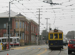
Occasionally PCCs and other cars from the heritage fleet used on the MUNI F-Market Line are seen operating on the J-Church as the cars travel between Market Street and the yard, and can be seen on fan trips on any of the lines. PCC streetcars were used on the Metro lines prior to the 1980 opening of the Metro Subway, when the Boeing-Vertol LRV cars took over.
Photo Gallery
| Five Random Images | ||||
 Image 19503 (1158k, 1600x1600) Photo by: Roberta Hill Collection of: David Pirmann Location: Judah/10th |  Image 56337 (188k, 864x574) Photo by: Peter Ehrlich Location: San Jose/Geneva |  Image 62050 (178k, 864x569) Photo by: Peter Ehrlich Location: San Jose/Seneca |  Image 100500 (183k, 930x698) Photo by: Peter Ehrlich Location: Duboce Portal |  Image 118983 (248k, 1044x703) Photo by: Richard Panse Location: 20th Street |
Page Credits
By Eric Haas and David Vartanoff.