Berlin, Germany U-Bahn
![]()
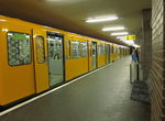
U-Bahn U8 station at Lindauer Allee. Photo by David Pirmann, September 2009.
Overview
The Berlin U-Bahn, Germany's oldest and largest, opened for service in 1902 with a line between Warschauer Straße and Ernst-Reuter-Platz. This was the first of the narrow-profile system, which ultimately reached four routes (today's U1, U2, U3 and U4, originally Lines A and B). These routes use stock which is only 2.3 meters wide, and the last extension opened in 1930. Portions of lines U1 and U2 are elevated. The last addition to the narrow lines occurred in 2000, when the U2 was extended by one station northward from Vinetastraße to Pankow. Line U4, which opened in December 1910 and has operated without change ever since, is the shortest in the U-Bahn system--only 5 stations and 2.9km long.
Starting in 1923, a new wide-profile (2.6m) network went into service, with the opening of Line C (now part of U6). Expansion of the "wide" lines continued rapidly until 1930, with incremental extensions on Lines U5, U6, U7 and U8 occurring between 1956 and 1996. North-south line U9 opened in 1961, the year of the building of the infamous Berlin Wall, and reached its full length by 1976. Line U7, at 31.8km, is the longest in the U-Bahn system.
The Berlin Wall disrupted service on east-west U-Bahn narrow-profile routes U1 and U2. Whereas U1 service ceased operating across the classic 1895 Oberbaumbrücke over the river Spree to Warschauer Straße, the U2 was most affected, with service to Potsdamer Platz station terminated from both sides. Later, the U2 in West Berlin between Gleisdreieck and Nollendorfplatz (serving Bülow) was shut down as it paralleled, but made a more circuitous route than the U1, between those two stations. Even though the Wall came down in 1991, through service was not restored on U2 until 1993. Finally, service across the Spree on U1 was restored in 1995. (Ironically, U2 was again shut down between Gleisdreieck and Nollendorfplatz starting in August 2006 due to the need to replace a bridge. This resulted in the U1 and the west half of U2 being combined to form a Route U12, and introduction of a 3-station shuttle between Uhlandstraße and Wittenburgplatz.) As of December 2006, service on the U2 through Nollendorfplatz and Bülowstrasse to Gleisdreieck had been restored, and the combined U1/U2 service was discontinued.
The older sections of the U-Bahn feature many spectacular and handsome stations. The most ornate station, hands down, is Heidelberger Platz on the U3, with its tall arched ceilings. Other stations of note include Sophie-Charlotte Platz and Klosterstraße on the U2; the latter features a display of an original U-Bahn car. The station house at Wittenburgplatz is also noteworthy. Of course, the elevated sections of U1 and U2 are spectacular, and reminiscent of the above-ground portions of the Paris Métro. Gleisdreieck Station is a double-elevated station, with U1 on the top level, and U2 on the lower level. The stations on the newer system, as a rule, are more mundane. One exception is Zoologischer Garten on the U9, with its animal decorations on the walls. Alexanderplatz on the U5 is a high-ceilinged station, creating the atmosphere of spaciousness.
Most of the rolling stock on the narrow-profile system (numbers 494-999) dates to the 1960s, but has been rebuilt at least once. Some trains of East German stock (200-300 and 1070-series), built as narrow versions of typical Communist-era subway cars, still operate on the currently combined U1/U2 (U12). At least one new train of walk-through Bombardier train is now in service on the U12. This is the first new stock for the narrow network in over 20 years.
Over on the wide-profile routes, there are currently two classes of subway cars: the 2500s, dating from the 1960s/1980s, and the new walk-through 5000-series trains, dating to 2000/2001. D-stock, vintage 1957/1965, was sold to Pyongyang, North Korea starting in 1998.
Fares are standard BVG fares with certain station or travel direction restrictions. Day tickets with no restrictions are available for zones A and B, which covers the entire U-Bahn system, most of the S-Bahn, the trams and local buses. A 7-day pass is also available.
Service on most lines is every 3-5 minutes during the peak periods and between every 5-10 minutes at other times. On Friday and Saturday nights, U-Bahn lines U5, U6, U8, U9 and most of U2 and U7 operate 24 hours--probably the only Metro in Europe that doesn't close down entirely after midinght.
Station By Station
Line U4
Berlin's U-Bahn line U4 is a north-south-line, situated completely in the city's borough of Schöneberg. The line has only 5 stations and is 2.9 km (1.8 miles) long. It is the shortest of the U-Bahn lines. The volume of passengers is not very high, and trains run with only two cars, at a 5 minute frequency in rush hours and 10 minutes other times. There is no night operation.
In the beginning of the 20th century the then-independent city of Schöneberg was planning a municipal railway in its western part. There were long discussion about whether a underground, elevated or suspended railway should be built. After the "Hochbahngesellschaft" (the association of the elevated railway in Berlin), which owned the "Stammstrecke" (the main line what is now the U1 and the U2), decided not to take part in this line, because they thought it wouldn't turn a profit, the city of Schöneberg built this line on its own. After two years of building the line opened December 1st, 1910. Schöneberg was thus the sixth city in Europe having an underground railway. One day before opening, Schöneberg and the "Hochbahngesellschaft" decided on a combined fare, and the management of the line went to the "Hochbahngesellschaft" with Schöneberg still being the owner of the line.
Nollendorfplatz is the northern terminal of the line. Here it makes a connection to the Stammstrecke lines (U1, U2, and U3). When the U4 was opened in 1910, the Stammstrecke station at Nollendorfplatz, which had opened in 1902, was an elevated station (the next stations westward are underground). An underground station named "Schöneberger Bahnhof" was built for the U4 in the south of Nollendorfplatz, with an underground passageway to the Stammstrecke station. Between 1915 and 1926, the Stammstrecke station at Nollendorfplatz was reconstructed with two underground levels and one elevated level. After the new station opened, station "Schöneberger Bahnhof" was closed, because the U4 could now stop in one of the underground levels of Nollendorfplatz. At Nollendorfplatz, all four of the narrow-profile U-Bahn lines are connected, and it is also the station with the most U-Bahn lines in Berlin. During World War II, the elevated station was heavily damaged and was rebuilt very simply. The dome roof it has today was rebuilt in 1999 with money from local donations.
Today, the U2 runs on the elevated tracks (two tracks, two side platforms). The upper of the two underground levels (two tracks, one island platform) has the eastbound trains on the U1 to Warschauer Straße. The lower level (also two tracks and one island platform) have the westbound U1 trains and terminating U3 and U4 trains. A set of tail tracks north of the station connect the upper and lower levels. The walls of the underground levels have grey/violet flagstones and yellow stilts. On the west end of the station is the entrance hall.
Viktoria-Luise-Platz is under the street "Motzstraße". It has a single island platform and the station is in a light green color. There are entrances on both ends of the platform. The southwest entrance is at "Viktoria-Luise-Platz" and it is the original one; the northwest entrance was opened in 2004 because of safety for the passengers (in 2000, there was a train fire at a station with only one entrance; since then it was decided, that every station in Berlin should have not less than two exits). This entrance is in the street "Motzstraße".
Bayerischer Platz is under the "Bayerischer Platz", named after the biggest state in Germany, Bavaria. The station colors are blue and white, just like the colors of Bavaria. It has a single island platform and the entrances are on both ends of the platform. The U4 station is in the upper level. This station was rebuilt twice, first, after massive damage in World War II, and a second time when the U7 station was built in lower level. U4 and U7 are connected via a tunnel. The station has a headhouse from 1957 which is more a simple one and not as beautiful as the original headhouse.
Rathaus Schöneberg is next and it is something very special. It seems like an underground station, but it is above ground. It has no walls, it has windows. The station is in the Rudolph-Wilde-Park, named after Rudolph Wilde, who was mayor of Schöneberg at the time the U4 was built and the biggest supporter of the line. The park is one part of a very long park complex in the boroughs Schöneberg and Wilmersdorf. The original station name was "Stadt Park" (city park). The station was completely destroyed in 1945 but was reopened in 1951 in the same style with the name "Rathaus Schöneberg", named after the city hall of Schöneberg, which is just around the corner. The park is in a little valley and the station has a footbridge over it. The station has a shortened single island platform with a entrance at the northern end of the platform and an emergency exit on the other end of the platform.
Innsbrucker Platz is the last station of the line. It has a single island platform and is designed in light grey and red color. The station opened as "Hauptstraße" named after the street which is crossing the station. In 1933, the S-Bahn station on the nearby ring line opened and both stations were named Innsbrucker Platz.
Photo Gallery
| Five Random Images | ||||
 Image 64017 (173k, 1044x702) Photo by: Steffen Petrasch Location: Alexanderplatz |  Image 84869 (202k, 1044x788) Photo by: Steffen Petrasch Location: Johannisthaller Chaussee |  Image 113588 (181k, 788x1044) Photo by: David Pirmann Location: Uhlandstraße |  Image 113773 (205k, 1044x788) Photo by: David Pirmann Location: Westphalweg |  Image 121957 (269k, 695x1044) Photo by: Bernard Chatreau Location: Seestraße |
Photos By Location
U1
Photo locations: Warschauer Straße, Stralauer Tor, Oberbaumbrücke, Schlesisches Tor, Görlitzer Bahnhof, Kottbusser Tor, Prinzenstraße, Hallesches Tor, Möckernbrücke, Bet. Möckernbrücke and Gleisdreieck, Gleisdreieck, Kurfürstenstraße, Nollendorfplatz, Wittenbergplatz, Kurfürstendamm, Uhlandstraße
U2
Photo locations: Pankow, Vinetastraße, Schönhauser Allee, Eberswalder Straße, Senefelderplatz, Rosa-Luxemburg-Platz, Alexanderplatz, Klosterstraße, Märkisches Museum, Spittelmarkt, Hausvogteiplatz, Stadtmitte, Mohrenstraße, Potsdamer Platz, Mendelssohn-Bartholdy-Park, Gleisdreieck, Bülowstraße, Nollendorfplatz, Wittenbergplatz, Zoologischer Garten, Ernst-Reuter-Platz, Deutsche Oper, Bismarckstraße, Sophie-Charlotte-Platz, Kaiserdamm, Theodor-Heuss-Platz, Neu-Westend, Olympia-Stadion, Ruhleben
U3
Photo locations: Nollendorfplatz, Wittenbergplatz, Augsburger Straße, Spichernstraße, Hohenzollernplatz, Fehrbelliner Platz, Heidelberger Platz, Rüdesheimer Platz, Breitenbachplatz, Podbielskiallee, Dahlem-Dorf, Thielplatz, Oskar-Helene-Heim, Onkel Toms Hütte, Krumme Lanke
U4
Photo locations: Nollendorfplatz, Viktoria-Luise-Platz, Bayerischer Platz, Rathaus Schöneberg, Innsbrucker Platz
U5
Photo locations: Hönow, Louis-Lewin-Straße, Hellersdorf, Cottbusser Platz, Neue Grottkauer Straße, Kaulsdorf Nord, Wuhletal, Elsterwerdaer Platz, Biesdorf-Süd, Tierpark, Friedrichsfelde, Lichtenberg, Magdalenenstraße, Frankfurter Allee, Samariterstraße, Frankfurter Tor, Weberwiese, Strausberger Platz, Schillingstraße, Alexanderplatz, Berliner Rathaus (U55), Spreeinsel (U55), Brandenburger Tor (Unter den Linden) (U55), Bundestag (U55), Berlin Hauptbahnhof (U55)
U6
Photo locations: Alt-Tegel, Borsigwerke, Holzhauser Straße, Otisstraße, Scharnweberstraße, Kurt-Schumacher-Platz, Afrikanische Straße, Rehberge, Seestraße, Leopoldplatz, Wedding, Reinickendorfer Straße, Schwartzkopffstraße, Zinnowitzer Straße, Oranienburger Tor, Friedrichstraße, Französische Straße, Stadtmitte, Kochstraße, Hallesches Tor, Mehringdamm, Platz der Luftbrücke, Paradestraße, Tempelhof, Alt Tempelhof, Kaiserin-Augusta-Straße, Ullsteinstraße, Westphalweg, Alt-Mariendorf
U7
Photo locations: Rathaus Spandau, Altstadt Spandau, Zitadelle, Haselhorst, Paulsternstraße, Rohrdamm, Siemensdamm, Halemweg, Jakob-Kaiser-Platz, Jungfernheide, Mierendorffplatz, Richard-Wagner-Platz, Bismarckstraße, Wilmersdorfer Straße, Adenauerplatz, Konstanzer Straße, Fehrbelliner Platz, Blissestraße, Berliner Straße, Bayerischer Platz, Eisenacher Straße, Kleistpark, Yorckstraße, Möckernbrücke, Mehringdamm, Gneisenaustraße, Südstern, Hermannplatz, Rathaus Neukölln, Karl-Marx-Straße, Neukölln, Grenzallee, Blaschkoallee, Parchimer Allee, Britz-Süd, Britz-Süd Yard, Johannisthaller Chaussee, Lipschitzallee, Wutzkyallee, Zwickauer Damm, Rudow
U8
Photo locations: Wittenau, Rathaus Reinickendorf, Karl-Bonhoeffer-Nervenklinik, Lindauer Allee, Paracelsus-Bad, Residenzstraße, Franz-Neumann-Platz, Osloer Straße, Pankstraße, Gesundbrunnen, Voltastraße, Bernauer Straße, Rosenthaler Platz, Weinmeisterstraße, Alexanderplatz, Jannowitzbrücke, Heinrich-Heine-Straße, Moritzplatz, Kottbusser Tor, Schönleinstraße, Hermannplatz, Boddinstraße, Leinestraße, Hermannstraße
U9
Photo locations: Osloer Straße, Nauener Platz, Leopoldplatz, Amrumer Straße, Westhafen, Birkenstraße, Turmstraße, Hansaplatz, Zoologischer Garten, Kurfürstendamm, Spichernstraße, Güntzelstraße, Berliner Straße, Bundesplatz, Friedrich-Wilhelm-Platz, Walther-Schreiber-Platz, Schloßstraße, Rathaus Steglitz
Page Credits
By Peter Ehrlich and Steffen Petrasch.