Amsterdam, Netherlands Trams
![]()
Amsterdam GVB type 12G trams at V.U. Medical Center, terminal of route 16. Photo by David Pirmann, April 2004.
Overview
The 16 tram lines of central Amsterdam are the primary means of getting around this small city's "downtown" area. Streets are narrow and parking scarce so there are relatively few private automobiles; tram riding is encouraged. From almost every corner in the "centrum" part of the city one can see a tram crossing within a few blocks. (The real owners of the road in Amsterdam are pedestrians and bicyclists- the number of close calls between trams and cyclists or pedestrians that I saw was enormous, but I did not witness or hear of any accidents during my stay.)
The streets that have the tram lines generally have the tracks in a semi-private right of way which is offset by a small curb from the automobile traffic. The tram right-of-ways can be used by diesel buses and taxis as well. Some streets have the tracks in the center with two way traffic on the sides, others have the tracks on one side with one way traffic on one side. This arrangement allows fairly fast tram travel except in areas where the tracks are shared with all traffic or locations of "gantleted" single track. Occasionally there are unpaved, grassy private right-of-ways used (for instance on the 2/5 between Leidseplein and Paulus Potterstraat, and a place where a tram cuts directly through a grassy traffic circle at Haarlemermeercircuit).
Station By Station
Centraal Station
Centraal Station is the terminal point for 11 of the 16 tram lines (and 3 of the 4 Metro/Sneltram lines). The station serves trams feeding into it from two thoroughfares: Damrak and Nieuwezijds Voorburgwal. The system is operated with the Damrak lines (4, 9, 16, 24, 25) terminating in a four track terminal area on the east side of the Stationsplein, and the N.Z. Voorburgwal lines (1, 2, 5, 13, 17) terminating in a four track terminal area on the west side. Provision is made in the street trackage on Prins Hendrikkade to allow crossover between the two "divisions" upon entering or leaving Centraal Station but no services are operated in this manner. The famous Red Light District is a short walk to the east and south of the Centraal Station but no trams serve that area directly.
Departing Centraal Station, the lines serving Nieuwezijds Voorburgwal depart and cross the canal on the Damrak bridge, and then turn to the right along Prins Hendrikkade, and then left on a small private right-of-way onto N.Z. Voorburgwal. Damrak lines simply head directly out onto Damrak. A new line, the number #26, leaves Centraal Station to the east.
Nieuwezijds Voorburgwal Lines
We are now running southbound along Nieuwezijds Voorburgwal, in a center right-of-way shared by diesel buses and taxis. There's a single lane in each direction for automobile traffic on either side of our raised right-of-way. The N. Z. Voorburgwal is a gently-curving, tree lined avenue with many hotels and cafes along the sidewalks. Between here and the Paleis Royal, there is a station in the northbound direction almost at Prins Hendrikkade, and another one serving both directions about halfway between Prins Hendrikkade and the Paleis. At the intersection of N. Z. Voorburgwal and the Raadhuisstraat, there is a station serving the Paleis Royal, Dam Square, and the Magna Plaza, an ornate post office-turned-shopping mall with three levels of upscale shops.
At this location the tram routes diverge, with the 13, 17, and 14 (which traverses Dam Square on its "crosstown" route) turning right onto the Raadhuisstraat and the 1, 2, and 5 continuing south along the N. Z. Voorburgwal. The more interesting branch is this latter one, but lets take a short side trip along Raadhuisstraat first. The Raadhuisstraat carries traffic of the 13, 14, and 17 away from N.Z. Voorburgwal toward the eastern suburbs. The Raadhuisstraat skirts the southern edge of the neighborhood known as the Jordaan, and crosses four canals before reaching Marnixstraat. Along the way one passes the Westerkerk and the nearby Anne Frank House. At Marnixstraat, the line intersects with some of the "crosstown" services (see below).
Next up as we continue south along N.Z. Voorburgwal is Spui, the site of the Amsterdam Historical Museum and a large flea market of booksellers. The N. Z. V. in this area is again tree-lined, but now only has one traffic lane, heading northbound to Centraal Station, with the two-track tram right-of-way on the southbound side. A pedestrian shopping district, Kalverstraat, is a short walk from here. Just beyond the next station, at Spui, the Singel canal appears and we turn left to parallel it for a short distance into Koningsplein, better known as the location of the famous floating flower market along the Singel between here and Muntplein.
South of Koningsplein is one of the three segments of gantleted single track running through narrow, pedestrian-congested streets (the other two are on the 9 tram line between Utrechtsestraat and Waterlooplein, and on the 4 tram line along Utrechtsestraat.) These single-track operations are "gantlet" tracks, where the two tracks overlap but do not connect via switches. The Leidseestraat and Utrechtstraat single track areas consist of three passing areas at stations, each of which is positioned on a bridge over a canal (the Prinsengracht, Keizergracht, and Herengracht). Each passing area has enough length for two trams in each direction. It is unfortunate that these single track areas are in heavily congested areas shared by multiple lines as they add significant bottleneck to the running times, especially during special events like the yearly arts festival Uitmarkt, which took place while I was there. Access to the single track areas is not controlled by a mechanical or electronic signal system. Trams heading inbound to Centraal Station have the right of way in all circumstances. Drivers can give away that right (for instance, maybe they are selling tickets, or are a bit early on their schedule) by flashing their alternating lights.
We now arrive at Leidseplein, one of the busiest intersections in the city, but not for automobiles-- trams, pedestrians, and bicyclists rule the streets here. Three separate platform areas serve the seven tram lines (the 1, 2, 5 from Leidsestraat, and the 7 and 10 which arrive via Marnixstraat to the northwest and Weteringschans to the southeast) that intersect at this location. This particular square becomes a haven for performance art and other oddness during the afternoon and evening as onlookers throng the square, visiting its many restaurants and theaters.
Departing Leidseplein to the south, the lines diverge once more with the 1 tram heading out along avenue Overtoom (see below), and the 2 and 5 trams taking a left onto a grassy private right-of-way along the Stadhouderskade in front of the Marriott hotel, Lido cabaret theatre, Amsterdam Casino, and Hard Rock Cafe. Leaving the private-right-of-way the tram lines jog a small right as they head for the museum district. The Rijksmuseum appears on the left-hand side, with its world famous collection of paintings by Rembrandt, Vermeer, and other Dutch artists. Turning right onto Paulus Potterstraat, we travel past the area known as Museumplein, home of the Rijksmuseum, the Rijksmuseum Vincent van Gogh, which concentrates on its namesake and his peers, and the Stedelijk Museum, which covers the art world from post-impressionism to the present day (including its own small collection of van Gogh masterpieces).
Not to get off the subject of trams, but don't forget to visit the museums while you are here!
Our first tram ride will end here, and you can take whatever route you like to return to Centraal Station, where we'll cover the lines that start out by traversing Damrak.
Damrak Lines
The Damrak, an avenue on one side with tourist shops, small hotels, and sidewalk cafes, and on the other a boat basin for canal boat tours, has two tracks on the "southbound" side, and lanes for automobiles on the northbound side only (visible in the photos). Heading south, there is a station just prior to entering Dam Square, on one side a large pedestrian area in front of the Paleis Royal, and on the other, a National Monument surrounded by hotels and department stores. A loop track in this area provides the crosstown service on the number 14 tram on its way to Raadhuisstraat (see above).
Continuing south, the roadway becomes known as Rokin, and the trams eventually arrive at Muntplein. At this point the tram lines diverge, with the 4, 9, heading to Rembrandtplein, a pleasant tree-filled square surrounded by sidewalk cafes and theaters, and the 16, 24, and 25 taking Vijzelgracht to Weteringcircuit. We'll continue via Rembrandtplein and then return to Weteringcircuit as part of our look at the crosstown lines (see below). As we depart Rembrandtplein, we come across yet another area of gantlet trackage, allowing two-way tram service on the narrow streets.
Next up is Waterlooplein, the home of the largest flea market in the city. You can get everything here, from used bicycles, clothing, lots of spray paint (?), and of course, the ubiquitous wooden or delftware shoes. Nearby, along the Muiderstraat, is the Netherlands Film and Television Academy, and the Amsterdam Jewish History Museum, which together with the Anne Frank House paints a picture of Jewish life in the Netherlands, before, during, and after the German occupation of World War II. Further south along the Muiderstraat is a drawbridge over canal Nieuwe Herengracht, which politely opened while I was there. The second photo below shows the bridge opening and tram number 788 servicing route 20 patiently waiting to cross. Tram number 787 providing service on route 14 was waiting on the other side and crossed after the bridge closed.
South of the Nieuwe Herengracht, the tram lines enter an area known as Plantage, which is the home to Amsterdam's zoo, called Artis, a botanical garden, and other parks and attractions. The number 6 tram terminates in this area, with a three-track terminal area along Plantage Parklaan at the corner of Plantage Middenlaan. The 9 and 14 trams continue to Alexanderplein and across the canal Singelgracht to the Tropenmuseum. The trams take a left turn onto Mauritskade, and then a traffic circle/roundabout takes them onto Linnaeusstraat. This is the end of our second tram journey.
Crosstown Lines
A number of tram lines do not serve Centraal Station, and instead travel "crosstown" routes (these are the 3, 6, 7, 10, 12, and 14, the last of which traverses Dam Square). These are grouped into two major sets of lines providing an "inner" crosstown service and an "outer" crosstown service. These crosstown routes seem to operate on lesser frequency than the Centraal Station lines, although for large portions of the route the tracks are shared by multiple services (the 3 and 12 are paired up along Bilderdijkstraat, C.Huygensstraat, and Van Baerlestraat, and the 6, 7, and 10 are grouped together along Sarphatistraat and around the Oosterpark area).
The first, inner route is made up of various tram services along the Marnixstraat, Weteringschans, and Sarphatistraat. We'll take this route first, starting at the corner of Rozengracht and Marnixstraat. At this intersection, one can spot trams servicing the 6, 13, 17, lines from Centraal Station, and the 10 and 14 lines providing crosstown service.
If one were to take a number 10 tram from Rozengracht and Marnixstraat and head southeast, you would first arrive at Leidseplein (see above) and then you would travel along Weteringschans and arrive at Weteringcircuit, an intersection served by the 16, 24, and 25 trams from Centraal Station, and the 6, 7, and 10 on the crosstown routes. This is a pleasant park-like traffic circle with tram trackage circling it. Cafes and shops line the streets, and the old Heineken brewery is a short walk to the south.
Continuing on that number 10 tram, the line is now heading northeast along Sarphatistraat, and the next point of interest is Fredriksplein, the junction of the 6, 7, and 10 tram services and the 4 and 25 serving Centraal Station. If you were to stay on the number 10 you would shortly arrive at Alexanderplein and the Tropenmuseum, described above. Stepping off the tram at Tropenmuseum and taking a short walk south along Linnaeusstraat, you'd quickly arrive at Oosterpark, where you could catch a number 3 tram to Muiderpoortstation, or head further out on the number 14 tram to Flevopark.
Back at Linnaeusstraat, you could transfer to the "outer" crosstown lines roughly back in the direction that you came. This group of lines consists of the 3 and 12 along Ceintuurbaan, Van Baerlestraat, and C. Huygensstraat. Riding first southwest then turning northwest, you would pass Sarphatipark and Museumplein, both on the right hand side, and then arrive at the intersection of Overtoom & Van Baerlestraat, which normally sees traffic on the 1, 3, 6, and 12 tram lines, but on the day I was there, trams on the 2, 5, and 20 were rerouted through this intersection due to closure of Paulus Potterstraat during the Uitmarkt arts festival. This intersection is one of six grand unions in the tram network allowing a number of routing moves. (There are seven grand unions if you consider Fredriksplein. It is unusual because one leg of the union is around the Fredriksplein circle.)
Departing Overtoom again on the number 10, your ride would take you along the C. Huygensstraat and the Bilderdijkstraat, to the intersection of De Clercqstraat. Stepping off the number 10, you could wait for a number 13 to take you back toward Centraal Station, along De Clercqstraat, via the intersection of Rozengracht & Marnixstraat, described above.
Further Out
Once further away from Centraal Station, the tram lines frequently run down long, straight, tree-lined boulevards in private right-of-ways. Each tram line (except #5) ends in a multi-track loop with storage capacity for a varying amount of trams, and a crew quarters.
Additionally, an operating tram museum is located near Havenstraat Depot (off line 16).
Roster
| Numbers | Designation | Year | Status | Notes |
|---|---|---|---|---|
| 600-634 | 3G | 1959/1961 | Retired | High floor, single ended, five doors per car |
| 635-652 | 4G | 1962 | Retired | High floor, single ended, five doors per car |
| 653-669 | 5G | 1964 | Retired | High floor, single ended, five doors per car |
| 670-699 | 6G | 1966/1967 | Retired | High floor, single ended, five doors per car |
| 700-724 | 7G | 1967/1968 | Retired | High floor, single ended, five doors per car |
| 725-779 | 8G | 1974/1975 | Retired | High floor, single ended, five doors per car |
| 780-804 | 9G | 1979/1980 | In service | High floor, single ended, five doors per car |
| 805-816 | 10G | 1980 | In service | High floor, single ended, five doors per car |
| 817-841 | 12G | 1990/1991 | In service | Low floor in center section, single ended, doors on right, no rear door, four doors per car |
| 901-920 | 11G | 1989/1990 | In service | Low floor center section, double ended, doors both sides, four doors per side |
| 2001-2151 | Siemens Combino | 2002/2003 | In service | Low floor, single ended |
| 2201-2204 | Siemens Combino | 2002/2003 | In service | Low floor, double ended |
Other Trams. Trams 997-999 were borrowed from Duisberg, Germany to help alleviate a shortage of equipment on line 5. They are double-ended, and have five doors per side. They were returned to Duisberg after the double-ended Combino trams (2201-2204) were delivered. Also, in the late 1990's, some trams on loan from Rotterdam were used in the system.
The Lines
 Line 1
Centraal Station to Osdorp-De Aker via N.Z.Voorburgwal, Leidseplein, Overtoom
 Line 2
Centraal Station to Sloten via N.Z.Voorburgwal, Leidseplein, Willemsparkweg
 Line 3
Zoutkeetsgracht to Muiderpoortstation via Ceintuur Baan, Van Baerlestraat, Hendrickstraat ("crosstown")
 Line 4
Centraal Station to RAI via Damrak, Rembrantplein, Fredricksplein
 Line 5
Centraal Station to Amstelveen via N.Z.Voorburgwal, Leidseplein, WTC-Zuid, shared track with Sneltram 51
 Line 6
Centraal Station to Plantage Parklaan via N.Z.Voorburgwal, Westermarkt, Leidseplein, Frederiksplein
 Line 7
Surinameplein to Flevopark via Mercatorplein, Leidseplein, Sarphatistraat ("crosstown")
 Line 9
Centraal Station to Diemen via Damrak, Waterlooplein, Linnaeusstraat
 Line 10
Van Hallstraat to Azartplein via Marnixstraat, Leidseplein, Sarphatistraat ("crosstown")
 Line 12
Sloterdijk to Amstel via Van Baerlestraat, Ferdinand Bolstraat, Churchillaan ("crosstown")
 Line 13
Centraal Station to Geuzenveld via N.Z.Voorburgwal, Westermarkt, Mercatorplein
 Line 14
Sloterpark to Flevopark via Westermarkt, Dam Square, Rokin, Middenlaan ("crosstown")
 Line 16
Centraal Station to V.U. Medical Center via Damrak, Muntplein, C.Krusemanstraat
 Line 17
Centraal Station to Osdorp-Dijkgraafplein via N.Z.Voorburgwal, Westermarkt, Kinkerstraat
 Line 20
Former Circle Tram route operated in two services: clockwise CS, Dam, Museumplein, Leidseplein, Westermarkt, CS; counterclockwise CS, Westermarkt, Leidseplein, Museumplein, Dam, CS. Service discontinued in 2002.
 Line 24
Centraal Station to Stadionplein via Damrak, Muntplein, Weteringcircuit
 Line 25
Centraal Station to President Kennedylaan via Damrak, Muntplein, Weteringcircuit
Track Map
Amsterdam, Netherlands Trams - Track Map
Photo Gallery
| Five Random Images | ||||
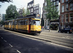 Image 11698 (514k, 1220x820) Photo by: David Pirmann Location: Nieuwezijds Voorburgwal | 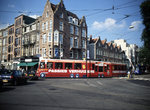 Image 12020 (548k, 1220x820) Photo by: David Pirmann Location: C. Huygensstraat & Overtoom | 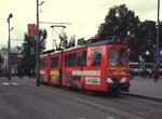 Image 22648 (107k, 820x582) Photo by: Theo Neutelings Location: Centraal Station |  Image 29035 (116k, 820x620) Photo by: Theo Neutelings | 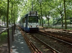 Image 53065 (306k, 1044x804) Photo by: Theo Neutelings Location: De Boelelaan/VU (51) |
Links
Urbanrail.net Amsterdam. Urbanrail.net's Amsterdam page (mostly about the Metro/Sneltram system).
Page Credits
By David Pirmann.