SIRT Staten Island Rapid Transit
Overview
SIRT, now known as MTA Staten Island Railway (SIR) is a 14 Mile, 21 Station, commuter rail line. Geographic north on the main line is timetable west (vice-versa too). Tottenville-bound trains are eastbound because Tottenville was the end of the generally west to east North Shore line that came across the bridge from New Jersey.
The St. George terminal (one of the few remaining boat-train links in the US), has 12 tracks, 9 that are used for regular service. Tottenville Station at the southern (western) terminus has a 3-track yard used for storage. There are shops for passenger equipment near Clifton Station, and for maintenance and other vehicles near Tompkinsville Station.
The line was operated as a subsidiary company of the Baltimore and Ohio Railroad from 1899 until 1971, when passenger service was taken over by the MTA.
A recently completed station lengthening project extended the length of 17 stations, with Atlantic (1 car-length), Nassau (4 car-lenghts) and Richmond Valley (4 car-lengths short). A signal project has been funded to reverse-signal the line from Hugenot to St. George; the line currently has the original B&O color position-light signals.
The operation of the original Staten Island Railroad was from Cranford Junction, NJ to St. George, Staten Island via the North Shore line, and then on to Tottenville or South Beach. The passenger operation on the North Shore (Arlington--St. George) and South Beach line (St. George--Wentworth Ave) was eliminated in 1953. All of the bridges over the North Shore line remain, and were recently rebuilt by NYC DOT.
The South Beach line is abandoned. Several bridges where the line crossed streets were removed, and one section of the right-of-way has actually had houses built on it. The Verrazano Bridge toll plaza destroyed a large part of the right-of-way.
The New Jersey section of the North Shore line, Cranford Juction-AK bridge was purchased by NJDOT, and CP Rail is looking at the Howland Hook container port as a NY-area terminal. The City of NY is looking to purchase the line from AK Bridge to St. George for resumption of freight service. (Freight service on the island ended in 1990 when the Port Ivory Proctor & Gamble plant shut down in 1990.) A contract was recently let to rehabilitatate the electrical and control systems of the AK lift bridge across the Arthur Kill, the longest vertical lift-span bridge in the world. The Howland Hook container port has been re-opened, and a paper recycling plant has located at the Travis end of the North Shore line. Additionally, with the imminent closing of the Fresh Kills landfill, a garbage transfer station is being proposed for the Port Ivory Proctor & Gamble plant. All of these industries intend to ship and recieve by rail, still, the future of rail service on Staten Island is far from certain.
Track Map
SIRT Track Map. Track Map (1949, w/North Shore and South Beach Branches)
Station By Station
We begin our ride at St. George, which has 6 island platforms and 12 tracks. Nine of the tracks are active for service to Tottenville, and two served the abandoned North Shore line. (Track 10 is the tail leg of a wye, used for non-revenue moves.) St. George is one of the few remaining ferry, bus, and railroad terminals in the U.S. and the only one in New York State. At the south end of the station the tracks enter a tunnel but the north end is open air (with the ferry terminal above). The railway uses continuous welded rail and full tie and ballast construction.
In the past, the train fare was paid at St. George on boarding, and on the train at intermediate stations; with the advent of the MetroCard, fare is charged only for boarding or alighting at St. George (payable with Metrocard or bus transfer Metrocard). There is a token booth that sells New York City Transit MetroCards and is staffed by SIRTOA employees rather than NYCT employees. The present system allows for some free rides--you only pay at St. George, as no other stations have fare control systems. To that end, the Tompkinsville station seems to have a large number of exiting passengers in the St. George direction-- presumably to avoid fare payment.
All stations south of St. George have vapor lighting and canopies only near exits (which are generally at the south end of the station). From the southern portal of the St. George tunnel, all the way to Tottenville, the line has two tracks. White on Black enamel/metal signs identical to those used in the subway system are used at all but a handful of stations (Tompkinsville, with no signage; Stapleton, Richmond Valley, Nassau and Atlantic are black paint stenciled on white plywood).
The newest station on SIRT, Ball Park, opened in 2001. This station is west of St. George and thus not on the "main line" of SIRT. This station is about 150 yards west of St. George along what used to be the North Shore line. The station is served by a single track spur from St. George and will operate on game days to serve the Staten Island Yankees ballpark.
First stop past the St. George tunnel on the "main" line is Tompkinsville. There are Maintenance of Way and Crew quarters just past the north end of the station. Passengers are instructed to exit from the last car, the conductor keying open a single door at the #2 end of the car. This station is on ground level adjacent to the Tompkinsville swimming pool. The south end of the station has a stairway up to the Hannah Street overpass, while the main entrance at the north end is connected to a pedestrian overpass which provides access to both Bay St. at Victory Blvd. and the pool.
Stapleton is the next stop, an island platform also situated on a concrete viaduct. South of the station, yard tracks can be seen entering the line on the St. George-bound side. This is the connection to the Clifton shops, and where SIR's R44 cars are moved to and from the TA system (by truck).
Clifton is next and is located partly on a bridge and partly on embankment. An interesting feature is the old waiting shelter on the St. George-bound side, which is in need of some TLC. The shelter had four windows, covered up on the southern side, the west side has evidence of windows existing in the past. The Tottenville side of the station formerly had an interlocking tower that controlled the link to the now defunct South Beach line. A close inspection of the Tottenville-bound platform reveals a stair to the trackway and former station exit, rendered useless due to platform extension in the early 1990's. Leaving this station, a look to the north will reveal the remnants of the South Beach cutoff, and a dismantled bridge. To the south, a spur on a pair of I-beams on concrete pillars is the location of an old coal, concrete, and lumber industry. The line varies from embankment to open cut with the terrain between here and the next station. Here, the line turns southward to Tottenville, no longer running along the harborfront.
Grasmere is next. Here there is an original brick station house from the 1933 grade separation project over the Tottenville-bound track at the south end. The building is open only during the AM rush hour. The platform is located in an open cut and has glass block and concrete windscreens attached to the canopy supports; the only exit is at the west end of the station. This is a major transfer point to the S53 bus to Brooklyn, connecting with the "R" subway at 86th St & 4th Ave. Grasmere crossover, consisting of two manual switches, is located just past the Fingerboard Rd. overpass north of the station.
Old Town is next and has a metal canopy waiting area. The exits at the north end go to Old Town Road; an additional exit to a short alley is on the Tottenville-bound platform. Just past the south end of the station, there is a spur that formerly served the press building of the Staten Island Advance (the last 'boro daily' in the city) and is now used as a storage spur for ballast cars.
Dongan Hills is an ADA-accessible station via overly-long ramps to the street at the east end. There is a stationhouse on the St. George-bound platform that had a ticket booth and benches until 1987, and then a token vending machine until July 1997. The station is bounded by Garretson Ave. and Seaview Ave., on overpasses, and North Railroad Ave. along the Tottenville-bound side.
Leaving Dongan Hills is a section of 3-track line, the third track (southern) now overgrown. This served a former coal distributor; grates between the rails led to chutes which now open into the backyards of homes that abut the embankment.
Jefferson Avenue is next, which has canopies over the only exit at the north end, to Jefferson Ave. Jefferson Ave. crossover, two manual switches, is visible from the north end. This station begins the descent from the embankment to the open cut of the next few stations.
Grant City marks the beginning of the 1964 grade separation (from Grant City to Bay Terrace, open cut). There are metal canopies at the south end under the 1964 stationhouse (again, only benches; the ticket sales ended in 1985 and the token machine was removed in July 1997). Approximately 150' from the north end there is a pedestrian crossover. The exits lead to to Lincoln Ave.
New Dorp has two side platforms, the north abutting the open cut, the southbound against a retaining wall, and is undergoing its second renovation in the last six years. The 1964 stationhouse is over the tracks at the south end. Exits on the north end lead to to New Dorp Lane and New Dorp Plaza (North and South Railroad Aves.) and on the south end to Rose Ave. and New Dorp Plaza. The original New Dorp stationhouse was moved to Richmondtown at the time of the grade crossing elimination project, and still exists.
Oakwood Heights, the last station to be grade separated (1965, open cut) has a stationhouse at the north end and a pedestrian bridge at the south end. This station serves Farrell High School, and can be a rough place between 2:30 and 3:30 on school days. North end exits to North and South Railroad Aves. and south to Guyon Ave.
A nice station which has recently been renovated is next, Bay Terrace, an island platform located on an embankment. The exits at both ends are well maintained, especially the north exit, which has a glass awning and brick sides. Both Bay Terrace and Jefferson Ave. are notable in that they have historically served residential areas, not business districts, as the other stations do. North exit to Bay Terrace, south exit to Justin Ave.
Next up is only other ADA compliant station, Great Kills. There are metal canopies over the exits at both ends; the north exit is to the 1933 stationhouse and Giffords Lane (original station name was 'Giffords'); south exit is ADA ramps and a pedestrian bridge to Giffords Glen. The station is located in an open cut, and is the only station other than Tottenville and St. George where trains are regularly terminated. New crossovers were installed in 1997 north of the station. The remains of a spur are visible at the south end. A reader writes that the spur was used to serve a grocery store at the south side of Great Kills in the 1940s.
Eltingville is next with two side platforms on an embankment. On the southbound (Tottenville-bound) side there are two exits, one leading to a parking lot along Eltingville Blvd. and the other to Richmond Avenue. Northbound (St. George-bound) platform has one entry/exit, alongside the viaduct at Richmond Avenue. This station is a major transfer point to the X1,4,5,6,9 buses to Manhattan, and the S59 and S79 buses to the Staten Island Mall, Hylan Blvd., and 86th St. Brooklyn. The canopy at the ends is concrete. The stationhouse here is on the street level at the Richmond Ave. exit, and at one time featured a signal lamp that alerted those waiting that a train was arriving. On the exterior of this stationhouse is a plaque noting the Great Kills to Huguenot grade separation project was done under the auspices of the Works Progress Administration.
Annadale is next, and has stationhouse, built in 1939, at the south end. A footbridge over the north end of the station provides an exit to North Railroad St. and a park and ride lot on the northwest corner. There are steel/concrete canopies over both the south (Annadale Rd.) and north exits.
The next station, Huguenot, is practically a mirror images of Annadale, this time with the stationhouse at the north end. A steel and concrete canopy is over the platforms at the north end exit (Huguenot Ave.), and an additional canopy is located about halfway down the southbound platform; however, there is no footbridge or parking here. Some AM peak express trains originate here, a set of crossovers are provided for this service north of the station. A spur used for ballast trains is off the northbound track across Huguenot Ave. from the station entrance. Huguenot has been shortened from the original station name, "Huguenot Park", and although there was never a park there, the NYPL branch is also named Huguenot Park.
Prince's Bay (alternately known as Princess Bay and Princes Bay) is next and suffers from a name problem--the maps show the name without the apostrophe while station signs show the apostrophe. The historically correct (and official) name is on the station signs. There are two side platforms with a concrete canopy and exit to Seguine Ave. on the north end, and a steel/concrete canopy near the south end of the southbound platform. This station was the last all-timber platform on the line (and perhaps the city), and was replaced in the early 1990's.
Pleasant Plains is next, with steel/concrete canopies and exit down at the south end to Amboy Rd. North of the station is another set of crossovers, and the right-of-way of a spur that formerly served Mount Loretto. The B&O served the Mt. Loretto non-electrified branch until 1950, which had some industry and a passenger station. The track was removed in the 60s and 70s with some ties were visible until the 80s. A coal dump trestle (shown in the photos) is all that remains, located behind the powerhouse.
Next up is Richmond Valley, a flag stop nestled between Page Ave. and Richmond Valley Rd. Exit from the Tottenville platform and end of the two wall platforms is up while the St. George platform exit is down. This station is in need of renovation. A grade crossing at Richmond Valley road was removed in 1940. The Tottenville-bound track has a non-electrified spur that once ran all the way to the Arthur Kill. The spur was built in the mid 1920s and dubbed by the B&O as the West Shore Line. The B&O delivered building materials to the Outerbridge Crossing construction site near the Kill. There was also a small industry on the spur known as Roselli Bros. The track remains intact today all the way to Page Ave. The switch at the spur is well kept and working. Note in the image taken from Page Ave., that the spur still extends quite far from the station, and the creek that runs parallel to the track. Very bucolic indeed! A St. George bound SIR train is visible in the background.
After Richmond Valley, two stations have been closed and replaced by a new station in between. The first of these is Nassau. Named after the nearby Nassau Smelting plant which it served, the plant had been closed for decades after being owned by AT&T, and then Lucent Technologies. The entire plant has been demolished, leaving no large source of ridership at Nassau. The station consisted of two wooden side platforms with a crossover bridge at the south end. The platforms here were shortened due to a structural issue in September 2010, allowing only a single car of the trains stopping here able to serve passengers from this station. Another spur, long since disconnected from the main line, was behind the northbound platform. After Nassau was Atlantic, another flag stop. The two side platforms here were only long enough for a single car, and the conductor would open a single door manually at this station for those few people wishing to enter or exit the train. Both Nassau and Atlantic were permanently closed on Saturday, January 21, 2017, and both will eventually be entirely demolished.
A new station built to replace Nassau and Atlantic is situated in between the sites of those two former stations, and is named Arthur Kill, located at Arthur Kill Road. The new station features a 150-car parking lot and transfers to Staten Island bus routes. The two side platforms are ADA-accessible and long enough to berth a typical four car SIRT train, with boarding at all doors, unlike the former short platforms at Nassau and Atlantic. An overpass connects the two platforms with ramps and stairways to the street and parking lot. Artwork entitled "Tottenville Sun, Tottenville Sky," by Jenna Lucente, is in the overpass. The artwork features wildlife and neighborhood archtecture common to the south shore of Staten Island. Arthur Kill station opened for service on Saturday, January 21, 2017.
We arrive at Tottenville and are treated to a view of the water to the east and south of the station. A crew room is located in the old stationhouse/tower at this station. The old slip for the ferry to Perth Amboy still stands nearby at the end of Bentley St. On a clear day, if you look hard, you can see the restored Perth Amboy slip on the New Jersey side of the Arthur Kill. There are three yard tracks on the east side of the center platform. Minor renovation is underway and exit is via a ramp at the southeast end (Main St.) and a pedestrian walkway and bridge allow exit at the north end. This is the southernmost rail station in New York State.
Roster
Passenger trains are made up of 64 R-44 type cars (also referred to as the SIRT ME-2 cars), modified to FRA standards for passenger equipment running on a freight road. These are being replaced gradually (beginning in 2024) with 75 R-211S cars built by Kawasaki.
| Unit Numbers | Type | Delivery |
|---|---|---|
| 400-466 (even) | R-44 MUE "A" Car - Single Ended Cab Unit | 1973 |
| 401-435 (odd) | R-44 MUE "B" Car - Blind Motor | 1973 |
| 388-398 (even) | R-44 MUE "A" Car - Single Ended Cab Unit | 1973 - transfer from subway |
| 389-399 (odd) | R-44 MUE "B" Car - Blind Motor | 1973 - transfer from subway |
| 100-174 | R211-S | 2024- |
Prior to the arrival of the R-44 cars, the line was operated with a fleet of rapid transit cars similar to the BMT Standards known as the ME-1 cars. This fleet consisted of 90 motor cars numbered 300-389 built in 1925; and 10 trailer cars numbered 500-509 built in 1926. In 1927 a fire at Tottenville destroyed five motor cars (319, 358, 376, 378, 382); to replace these, five trailer cars were converted to motor cars and renumbered (502 to 390; 505 to 391; 506 to 392; 507 to 393; 509 to 394). A fire on June 25, 1946 at St. George destroyed a further eight motor cars (307, 313, 316, 322, 333, 351, 377, 390), and two more were destroyed in a derailment at South Beach in 1948 (323, 363).
After the end of operation of the North Shore and South Beach lines on March 31, 1953, SIRT sold 25 motor cars and the remaining five trailer cars to New York City Transit; these were used around the BMT southern division on lines such as the Franklin and Culver shuttles. Most were scrapped in 1961.
On April 5, 1972, a further seven of the ME-1 motor cars were destroyed in a fire at the Clifton Shops (306, 311, 318, 326, 338, 372, 379). Also in 1972, three LIRR MP-72 cars (2505, 2517, and 2646) were tested on the SIRT, but they were out of service by 1973.
The remaining SIRT ME-1 cars stayed in service until replaced by the R-44 (ME-2) fleet in 1973. Most were scrapped, but two cars were added to museum collections (366 at the Seashore Trolley Museum, 388 at Shore Line Trolley Museum), and one car (353) was acquired by the Trolley Museum of New York but was stored in Travis Yard on Staten Island for many years until unceremoniously scrapped around 2004.
SIRT work equipment includes locomotives (Brookville Industries), hoppers, flatcars, and a caboose (crew car). Former work equipment included two Alco locomotives, #844 (ex-US Army) and #407 (ex-MTA LIRR).
North Shore Line
The western end of the SIRT North Shore line is still in service, now operated by New York Container Terminal at Howland Hook. The freight track extends west of Union Avenue to the Container Terminal and the CSX Arthur Kill Lift Bridge. Some pictures of the freight operation are below.
Photo Gallery
| Five Random Images | ||||
 Image 109502 (143k, 1024x768) Photo by: Robbie Rosenfeld Location: Prince's Bay | 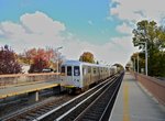 Image 109961 (247k, 1024x681) Photo by: Richard Panse Location: Jefferson Avenue | 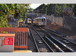 Image 115921 (312k, 1044x566) Photo by: Zach Summer Location: Jefferson Avenue | 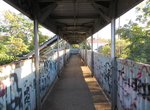 Image 140415 (155k, 1024x768) Photo by: Robbie Rosenfeld Location: Nassau |  Image 150630 (703k, 1067x1600) Collection of: Nicholas Fabrizio Location: Clifton Yard/Shops |
Photos By Location
Photo locations: St. George, Ball Park, Tompkinsville, Stapleton, Clifton, Clifton Yard/Shops, Grasmere, Old Town, Dongan Hills, Jefferson Avenue, Grant City, Bet. New Dorp & Grant City, New Dorp, Beach Avenue grade crossing, Oakwood Heights, Bay Terrace, Great Kills, Eltingville, Annadale, Huguenot, Prince's Bay, Pleasant Plains, Richmond Valley, Nassau, Arthur Kill, Atlantic, Tottenville, (Misc/Unknown), Clifton Junction, Rosebank, Belair Road, Fort Wadsworth, Arrochar, Cedar Avenue, Sand Lane, South Beach, Wentworth Avenue, New Brighton, Sailors-Snug Harbor, Livingston, West Brighton, Port Richmond, Tower Hill, Elm Park, Lake Avenue, Mariners Harbor, Harbor Road, Arlington, Gulfport, Travis, Port Ivory, Howland Hook
Related Documents
Staten Island Line to Electrify (1924), Electric Railway Journal, 1924
Page Credits
By Hank Eisenstein and Peggy Darlington.